North America Drone Market Report by Application, Type, Countries and Companies Analysis 2026-2034
Buy NowNorth America Drone Market Size and Forecast
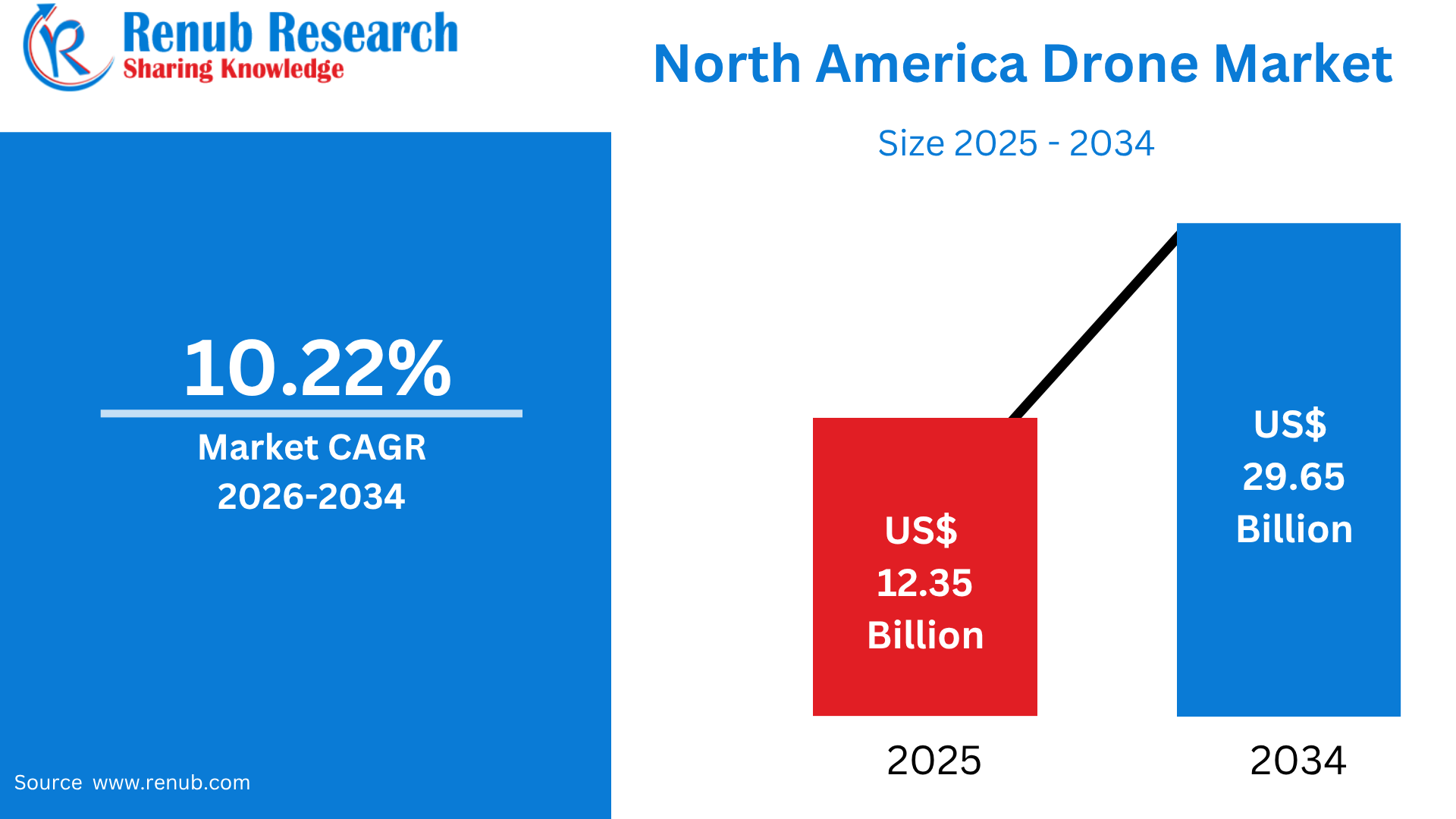
The North America Drone Market is anticipated to expand from US$ 12.35 billion in 2025 to US$ 29.65 billion by 2034, registering a CAGR of 10.22% during 2026–2034. Market expansion is being supported by the increasing deployment of drones across defense, agriculture, construction, logistics, surveillance, and infrastructure inspection applications. In addition, advancements in autonomous flight systems, artificial intelligence (AI), computer vision, and real-time data analytics are enhancing drone capabilities and broadening their commercial applications.
What is the North America Drone Market and What Are Its Uses & Popularity?
The North America Drone Market comprises unmanned aerial vehicles (UAVs) used for commercial, government, defense, agricultural, industrial, and recreational applications. Drones range from small multirotor aircraft to sophisticated autonomous systems equipped with cameras, sensors, GPS, artificial intelligence, and real-time analytics. In the United States, the FAA reported that more than 800,000 drones were registered for integration into the National Airspace System in its 2025 drone-integration framework. Drones are widely used for aerial photography, infrastructure inspection, construction surveying, agriculture, mapping, emergency response, public safety, defense, logistics, and package delivery. Commercial operators can conduct eligible small-drone operations under FAA Part 107, while advanced applications such as BVLOS delivery require additional regulatory authorization. Canada also demonstrates strong adoption: Transport Canada recorded 122,945 registered drones and 141,956 Basic Pilot Certificates as of August 13, 2026. The expanding drone ecosystem across the U.S. and Canada reflects growing demand for faster data collection, automation, remote monitoring, and cost-efficient aerial operations.
USA Drone Market Statistics
- More Than 855,000 Drones Registered in the United States
The U.S. Federal Aviation Administration (FAA) reported approximately 855,860 registered drones in 2026. Of these, around 536,183 were recreational drones, while approximately 316,075 were registered for commercial use, demonstrating the substantial scale of the U.S. drone ecosystem. - Recreational Drones Account for Approximately 63% of Registrations
Recreational UAVs represent roughly 63% of total registered drones in the United States. The high share reflects continued interest in drones among hobbyists, enthusiasts, photographers, and other consumer users. - Commercial Drones Represent About 37% of Registered UAVs
Commercial drones account for approximately 37% of U.S. drone registrations. Their adoption spans construction, agriculture, infrastructure inspection, surveying, real estate, public safety, logistics, and other industrial applications. - More Than 405,000 Part 107 Remote Pilot Certificates Issued
The FAA had issued approximately 405,682 Part 107 Remote Pilot Certificates by the end of 2024. This substantial certified operator base reflects the expanding professional workforce supporting commercial and government drone activities. - Approximately 38.3 Million Drone Flights Recorded in 2024
FAA estimates indicate that approximately 38.3 million drone flights occurred across the United States during 2024. The figure demonstrates the extensive utilization of UAVs for both recreational and commercial activities. - Commercial Drone Flights Exceeded 16 Million
Commercial operations accounted for approximately 16.6 million drone flights in 2024. This level of activity highlights the increasing integration of UAVs into business operations, industrial inspections, surveying, agriculture, and other professional applications. - Recreational Drone Flights Reached Approximately 21.7 Million
Recreational users conducted an estimated 21.7 million drone flights during 2024. The substantial volume demonstrates continued consumer demand for drones for leisure, photography, videography, and other personal applications. - Remote ID Compliance Reached Approximately 95%
Following the introduction of FAA Remote ID requirements, reported compliance among commercial drone operators reached approximately 95% by 2025. Remote ID supports identification and tracking of participating drones and is intended to strengthen the safety and accountability of U.S. airspace. - DJI Holds More Than Half of the U.S. Commercial Drone Market
Industry reports cited by Reuters indicate that DJI accounts for more than 50% of the U.S. commercial drone market. The company’s significant market presence has continued despite heightened regulatory and supply-chain scrutiny surrounding Chinese-made drone technology. - DJI Drones Accounted for More Than 96% of Detected Drone Platforms in ASSURE Research
FAA-supported ASSURE research found that DJI-manufactured drones represented more than 96% of detected drone platforms in the monitored U.S. airspace research. The finding illustrates DJI’s substantial presence among drones observed in the evaluated operating environment.
Growth Drivers of the North America Drone Market
Expanding Commercial and Industrial Applications
The increasing adoption of drones across commercial and industrial operations is a major growth driver for the North America Drone Market. Companies are using UAVs for construction surveying, infrastructure inspection, mining, energy monitoring, agriculture, real-estate imaging, telecommunications, and logistics because drones can collect aerial data quickly while reducing the need for conventional manual inspections. In the United States, the FAA’s 2025 drone-integration framework identified package delivery, agriculture, aerial surveying, civic applications, and flight testing among potential scalable drone operations. Agriculture is particularly relevant because U.S. farms are increasingly adopting precision technologies; USDA data show that 68% of large-scale crop-producing farms used yield monitors, yield maps, and soil maps in 2023. Drones can complement these technologies through crop imaging, field monitoring, and targeted agricultural operations. As businesses increasingly prioritize automation, labor efficiency, real-time information, and predictive maintenance, demand for commercial drone platforms and related services is expected to continue expanding across North America.
Advances in AI, Automation, and BVLOS Operations
Technological advancements in artificial intelligence, computer vision, autonomous navigation, sensors, and automated flight control are significantly expanding the capabilities of drones. Modern UAVs can capture high-resolution imagery, identify objects, map terrain, monitor infrastructure, and generate actionable data with limited human intervention. The development of Beyond Visual Line of Sight (BVLOS) operations is particularly important because it could enable drones to conduct longer-distance and more scalable commercial missions. In August 2025, the FAA proposed a BVLOS rule covering operational requirements, aircraft manufacturing, separation from other aircraft, authorizations, security, and reporting. The FAA has also identified scalable BVLOS operations as an important pathway for applications such as package delivery, agriculture, and aerial surveying. AI-enabled autonomy can further reduce pilot workload and improve operational efficiency. As these technologies mature, drones are increasingly moving beyond remotely controlled aircraft toward intelligent platforms capable of performing complex missions, supporting continued market expansion.
Growing Regulatory Support and Drone Infrastructure
The gradual development of clearer regulatory frameworks and drone infrastructure is creating favorable conditions for market growth across North America. In the United States, FAA Part 107 provides a regulatory framework for commercial small-UAS operations involving drones weighing less than 55 pounds, covering a broad range of business and government applications. The FAA is also developing pathways for more advanced operations, including BVLOS flights and drone package delivery. Canada has similarly expanded its regulatory framework. Transport Canada’s new rules for lower-risk BVLOS and medium remotely piloted aircraft operations came into force in November 2025, introducing mechanisms including Level 1 Complex Pilot Certificates and RPAS Operator Certificates. By August 2026, Canada had 615 active RPAS Operator Certificates and 709 Level 1 Complex Pilot Certificates. These regulatory developments are helping establish clearer pathways for commercial drone deployment, encouraging investment in UAV technologies and supporting broader adoption.
Challenges of the North America Drone Market
Regulatory and Airspace Integration Complexity
Regulatory requirements and airspace integration remain significant challenges for the North America Drone Market. Although commercial drone rules have become more established, operators must comply with requirements covering pilot certification, aircraft registration, operating areas, airspace authorization, safety, and flight restrictions. Under FAA Part 107, many small-UAS operations must maintain visual line of sight, while certain activities require additional authorization or waivers. Package delivery operations involving BVLOS flights require operators to navigate additional certification and authorization requirements under the FAA framework. Canada has also introduced more pathways for BVLOS operations, but operators must meet specific pilot, organizational, and operational requirements. These regulatory differences and evolving requirements can increase compliance costs and lengthen deployment timelines, particularly for businesses seeking to operate fleets across multiple jurisdictions. The need to safely integrate increasing numbers of drones with conventional aircraft therefore remains an important market challenge.
Safety, Privacy, and Cybersecurity Concerns
Safety, privacy, and cybersecurity issues can constrain wider drone deployment, particularly in densely populated or sensitive areas. Drones operate in shared airspace and can create risks if they lose control, interfere with other aircraft, or operate improperly around people and property. The FAA requires drone operators to avoid manned aircraft and prohibits careless or reckless operations under its small-UAS framework. Privacy is another concern because drones equipped with high-resolution cameras and sensors can collect images and information about individuals, properties, and infrastructure. Cybersecurity risks can also arise from unauthorized access to drone controls, communications, navigation systems, or collected data. Canada specifically reminds operators to follow applicable privacy and trespassing laws when flying drones. Addressing these challenges requires stronger cybersecurity measures, reliable navigation and collision-avoidance technologies, secure data management, pilot training, and clear operational protocols. These requirements can increase deployment costs while influencing public acceptance of drone technologies.
Drone Launches in North America
- HoverAir Aqua – Zero Zero Robotics (2025): Introduced as a fully waterproof self-flying drone designed for water sports, marine activities, and operation around aquatic environments.
- IQ Nano Indoor Drone – ZenaTech Inc. (2025): A compact autonomous indoor UAV developed for U.S. defense, security, inventory management, and search-and-rescue applications.
- DRONE VOLT KOBRA – DRONE VOLT (2025): Launched for U.S. production with applications in defense, emergency response, and law enforcement, supporting specialized professional missions.
- IQ Quad – ZenaTech Inc. (2026): An autonomous vertical takeoff and landing (VTOL) drone designed for land surveying, construction, urban planning, and real-estate applications.
- Guardian – BRINC Drones (2026): A Drone-as-First-Responder (DFR) platform featuring Starlink connectivity, extended operational range, and emergency-response payload capabilities.
- Outrider Border Drone – Draganfly Inc. (2025): A long-endurance UAV developed for border surveillance, logistics, public safety, and monitoring operations.
- LUCAS – SpektreWorks (2025): A low-cost unmanned combat attack system associated with U.S. Navy development and deployment, representing advances in autonomous military drone technology.
- Project Talon – Northrop Grumman (2025): A collaborative combat-aircraft concept designed to operate as an autonomous “wingman” alongside crewed military aircraft in future defense missions.
- Wing Delivery Drone Expansion – Wing (2026): Wing expanded U.S. drone-delivery operations through partnerships with retailers and food-service businesses, supporting faster last-mile delivery using autonomous UAVs.
Precision Agriculture Accelerates Drone Adoption
North America Agriculture Drone Market is expanding as farmers increasingly use UAVs for precision crop management, field mapping, and resource optimization. Agricultural drones equipped with multispectral, thermal, and high-resolution cameras can identify crop stress, irrigation issues, pest activity, and nutrient deficiencies more efficiently than conventional field inspections. According to the USDA Economic Research Service, 68% of large-scale U.S. crop-producing farms used yield monitors, yield maps, and soil maps in 2023, demonstrating increasing adoption of precision-agriculture technologies. Drones complement these systems by providing detailed aerial imagery and localized field intelligence. Farmers can use this information to optimize fertilizer, pesticide, and water applications, potentially reducing input waste and improving productivity. Labor availability is another factor supporting adoption, particularly on large farms requiring frequent field monitoring. As agricultural operations become increasingly data-driven, integration between drones, farm-management software, GPS systems, and AI-powered analytics is expected to strengthen. These developments are creating broader opportunities for agricultural drone manufacturers and service providers across North America.
Aerial Surveying and Site Monitoring Increase Demand
North America Construction Drone Market is benefiting from increasing use of UAVs for surveying, mapping, inspection, and project monitoring. Construction companies can capture aerial imagery and generate 3D models, orthomosaic maps, digital elevation models, and progress reports, allowing project managers to monitor sites more efficiently. The U.S. construction sector remains substantial, with the U.S. Census Bureau reporting approximately $2.2 trillion in annual construction spending during 2025, creating a large potential application base for drone-based technologies. Drones can reduce the time required for surveying large sites while providing repeatable data for monitoring project progress. Contractors also use UAVs to calculate stockpile volumes, inspect roofs and structures, document completed work, and identify deviations from project plans. Integration with building-information modeling and construction-management platforms is further improving the value of aerial data. As infrastructure development, commercial construction, and urban redevelopment continue across North America, demand for drone-enabled surveying and monitoring is expected to increase.
Public Safety Agencies Expand UAV Applications
North America Law Enforcement Drone Market is growing as police and public-safety agencies increasingly use UAVs for situational awareness, search and rescue, emergency response, and incident documentation. Drones equipped with high-resolution cameras, thermal sensors, lighting systems, and communications equipment can provide aerial information without immediately placing personnel in potentially hazardous environments. In the United States, the FAA’s drone framework supports public-safety operations while requiring agencies to comply with applicable operational rules and airspace requirements. The FAA has also reported growing use of drones for public safety, disaster response, and other civic applications. Agencies can deploy drones to locate missing persons, assess disaster areas, document accident or crime scenes, monitor large events, and evaluate hazardous locations. Thermal imaging can be particularly useful during nighttime search-and-rescue missions. However, privacy, data management, and evidence-handling requirements remain important considerations. Continued investment in public-safety technology and improvements in autonomous flight, sensor capabilities, and real-time communications are expected to support further adoption across North America.
Vertical Takeoff and Hovering Capabilities Support Diverse Applications
North America Rotary-Wing Drones Market is expanding because multirotor UAVs offer operational characteristics that are well suited to inspection, surveillance, mapping, agriculture, photography, and public-safety applications. Unlike fixed-wing aircraft, rotary-wing drones can take off and land vertically, hover over specific locations, and operate within comparatively confined areas. These capabilities make them particularly useful for inspecting bridges, power lines, telecommunications infrastructure, buildings, construction sites, and industrial facilities. Improvements in battery technology, obstacle detection, stabilization, GPS navigation, and autonomous flight are increasing operational reliability. Multi-sensor payloads can combine visible-light cameras with thermal or other specialized sensors, enabling operators to collect different types of information during a single mission. The growing availability of compact, commercially deployable UAV platforms is also making rotary-wing systems accessible to smaller businesses and public agencies. As demand increases for remote inspection, aerial monitoring, emergency response, and precision data collection, rotary-wing drones are expected to remain an important segment of the North American UAV industry.
United States Commercial, Government, and Defense Applications Drive Expansion
United States Drone Market is expanding through increasing adoption across agriculture, construction, infrastructure inspection, public safety, defense, surveying, logistics, and aerial imaging. FAA data indicate the scale of the domestic ecosystem: the agency’s 2025 drone-integration framework reported more than 800,000 registered drones, including both recreational and commercial aircraft. Regulatory developments are also creating pathways for more advanced applications, including expanded Beyond Visual Line of Sight (BVLOS) operations. In 2025, the FAA proposed rules addressing BVLOS operations, aircraft requirements, separation from other aircraft, security, and reporting. In addition, autonomous systems are being tested for public safety and maritime applications. For example, in 2026 the U.S. Coast Guard began testing autonomous sail drones on the Great Lakes equipped with 360-degree cameras for applications including search and rescue, environmental response, and law enforcement. Growing investments in AI, autonomy, sensors, and defense UAV capabilities are expected to support continued market development, while airspace integration, cybersecurity, privacy, and supply-chain considerations remain important market issues.
Canada Industrial and Government Adoption Supports Market Development
Canada’s Drone Market is expanding across agriculture, mining, construction, infrastructure inspection, environmental monitoring, public safety, and logistics. The country’s large geographic area and dispersed infrastructure create opportunities for UAVs to collect aerial information efficiently across locations that can be difficult or expensive to access using conventional methods. Transport Canada reported 122,945 registered drones and 141,956 Basic Pilot Certificates as of August 13, 2026, demonstrating the scale of Canada’s regulated drone ecosystem. Regulatory developments are also supporting more sophisticated operations. New Canadian rules introduced pathways for lower-risk BVLOS and medium remotely piloted aircraft operations, including Level 1 Complex Pilot Certificates and RPAS Operator Certificates. Mining companies can use drones for site mapping and stockpile measurement, while farmers can employ UAV imagery for crop monitoring and field management. Infrastructure operators similarly use drones to inspect utilities and other assets. Defense cooperation is also creating additional demand; in 2026, Canada and Ukraine announced an agreement involving North American production of Ukrainian-designed military drones. Market development will nevertheless depend on continued improvements in airspace integration, regulatory compliance, cybersecurity, and privacy protections.
Mexico Agriculture, Infrastructure, and Logistics Create New Opportunities
Mexico Drone Market is developing as businesses and government organizations increasingly recognize UAVs as tools for agriculture, infrastructure inspection, energy, environmental monitoring, public safety, and logistics. Agricultural users can employ drones for crop monitoring, field mapping, irrigation assessment, and targeted application of agricultural inputs, while energy and infrastructure companies can use UAVs to inspect remote or difficult-to-access assets. Mexico’s expanding digital economy and growing commercial interest in automation are creating additional opportunities for drone-based data collection and services. The logistics sector is also emerging as an important application area. In October 2025, German drone manufacturer Wingcopter partnered with pharmaceutical logistics company Sincronía Logística to transport medical supplies by air for the Mexican Red Cross, demonstrating the potential of UAVs for healthcare logistics. As commercial use expands, requirements for airspace coordination, operator training, cybersecurity, and privacy will remain important. Further development of regulatory frameworks and drone infrastructure, together with improvements in autonomous flight and payload capabilities, is expected to support wider adoption across Mexico.
Market Segments
Application
- Construction
- Agriculture
- Energy
- Entertainment
- Law Enforcement
- Other Applications
Type
- Fixed-wing Drones
- Rotary-wing Drones
Countries
- United States
- Canada
- Mexico
- Rest of North America
All the Key players have been covered from 5 Viewpoints:
- Overviews
- Key Person
- Recent Developments
- SWOT Analysis
- Revenue Analysis
Company Analysis:
- Drone Delivery Canada
- AeroVironment Inc.
- UVify Inc.
- Intel Corporation
- Alphabet Inc.
- Boeing Company
- Teledyne FLIR LLC
- 3D Robotics Inc.
Report Details:
| Report Features | Details |
| Base Year |
2025 |
| Historical Period |
2022 - 2025 |
| Forecast Period |
2026 - 2034 |
| Market |
US$ Billion |
| Segment Covered |
Application, Type and Countries |
| Countries Covered |
|
| Companies Covered |
|
| Customization Scope |
20% Free Customization |
| Post-Sale Analyst Support |
1 Year (52 Weeks) |
| Delivery Format |
PDF and Excel through Email (We can also provide the editable version of the report in PPT/Word format on request) |
Customization Services available
- Analysis of Market Size and Its Segments
- More Company Profiles (Upto 10 without any additional cost):
- Additional Countries (Other than mentioned Countries):
- Region/Country Specific Reports:
- Market Entry Strategy:
- Region-Specific Market Dynamics:
- Regional Market Share Analysis:
- Trade Analysis:
- Production Insights:
- Others Customized Requests:
For more information contact our analysts.
Need More Assistance?
- Talk to our analysts to get more precious information on the current market trends.
- Include more countries and segments and customize the report based on the final requirement.
- Get a competitive advantage in your industry by knowing the report findings and making a positive impact on your revenues and operations.
- Our analysts are always ready to provide more help and pertinent information if you need any additional assistance.